My Book!!

One opportunity that the blog has brought me is the co-authoring of a guidebook, Paddling Southern Maine! It is something in which I take a lot of pride! My writing partner, Sandy Moore, and I have created a book with 54 amazing trips that are within about an hour of Portland! Our motto as we wrote the book was wanting to 'get people to spend the day on the water and not in their cars!'

If you want more information on our book please click on the image of the book below.

Sandy and I are available to attend/present various functions/events. Please email me at mainekayakgirl@gmail.com for more information!

Sunday, August 4, 2013

Highland Lake Falmouth/Windham, Maine

Body of Water: Highland Lake, Falmouth/Windham, ME [Maine Gazetteer Map 5, D3 ]

Directions (from Portland, ME): Take 302 west from Portland towards Windham.  After crossing Riverside Street stay on 302 for just over a mile.  Rt. 302 widens to two lanes  just after the traffic light at Brook/Pride St.  There is a right turning arrow in the right lane, follow this arrow and turn right onto Elmwood Avenue, which turns into Duck Pond Road.  (I am not sure at what point it changes as there is no road sign or marker.)  COntinue following  Elmwood/uck Pond Rd. for about 2.2 miles then take Mast Rd. which will be on your right.   Stay on Mast Road for about 0.6 miles and on the left you will see a sign for the public access point as well as a sign for Lowell Farm Rd.  The access point is down Lowell Farm Rd.  Follow the signs for the access point.  You will turn left off Lowell Farm Rd to the parking area.

This is 302 West after the light at the intersection of 302 & Pride St.  (Taken from the Subway Sandwich shop across the street.)  Turn Right, follow the arrow! 

The Public Access sign on the corner of Mast Rd. and Lowell Farm Rd. Turn Left here! 

This sign is on Lowell Farm Rd. Turn left to access the launch site.  

You will then drive down a driveway to get to the parking/launch site. 


Boat Launch:  The boat launch is sand and gravel.  Where you put in is quite shallow.  Easy to put in.  As you can see from the picture there are rocks that prevent boat trailers from using this access point.


Parking: There was parking spaces for 6-8 vehicles in parking spots and the road was wide enough for other vehicles to park along it if needed.  (There was one truck parked along the road when I was there because it had hauled a trailer with multiple canoes.)  There is no fee for parking here.

*There are no bathroom facilities at this launch point.  

Wildlife: While paddling I saw a frog, two loons, an eagle, a blue heron, and some other birds.  Many people were fishing here as well.

Notes: Highland Lake is very close to Portland.  It is easy to find and is perhaps one of the most accessible places to paddle if you want to stay close to Portland.  This is a lake where you could spend an hour on the water or make a day of it and really take your time exploring the entire lake.  When I first arrived I unloaded my kayak and there were two canoes and two kayaks coming off the lake.  The sky darkened and I heard a loud clap of thunder.  I asked the people coming off the water how it looked and they said they had paddled quickly to get back to the launch site to get off the water.  I decided to stay put for a while.  I reloaded the kayak, to get it out of the way in case other people showed up... and waited.  The storm was pretty loud and the rain came down pretty hard, but I was determined to get out on the water so I waited.  After about 40 minutes the sky lightened up and the sun was once again shining.  I decided to go ahead and get out on the water while keeping an eye to the sky.  I was not the only person on the water.  While I was out I saw two other kayakers, two canoes, a couple of fishing boats, a lot of party boats (pontoon boats), a sailboat, and a couple of jet skis.  There was more sound pollution than I am used to when I kayak due to the motorized vessels on the water.  One important note when kayaking on busy lakes, be smart about where you are in comparison to boats.  I was paddling and even though my red kayak usually stands out, one man in a party/pontoon boat did not see me as he was backing out of his dock.  I had to back paddle quite a bit to stay out of his way as he kept turning in my direction.  Eventually he saw me and apologized.  Be aware of what other traffic is around and whether or not they can see you!
There are many camps/houses along the lake.  I liked seeing so many people using the lake because many places that I kayak have unused summer homes, but I admit I prefer places that have less boat traffic than I saw today on Highland Lake.  That being said, I know some people prefer to be on a body of water where there are other people around.  Some people feel safer with more people around.  I prefer the quieter locations, but this is a place I will return to on those days where I need to get on the water and don't have as much time to go a bit further from home.  In many places I could easily see the bottom of the lake.  The water was shallow in many places and very clear.  There were many buoys on the lake, marking rocks.  The main part of the lake seemed pretty open and bigger boats were going fairly fast, but closer to the edges and more pond like areas the boats, if they went there, were going much more slowly. Here are some pictures of my paddle today:


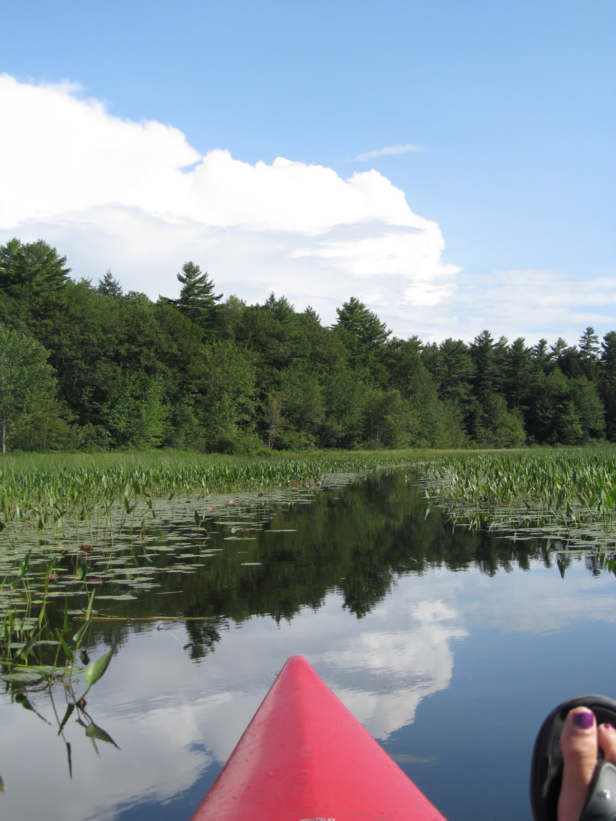
It seems like there were parts of the lake that were more like a pond, given the vegetation.  After putting in,  you can go left which takes you towards someone's home and through many lily pads and other water plants.  That is the area where I saw the heron.  To the right, from the launch site, is the more open waters of the main part of the lake.   


I almost didn't notice this guy, but he was watching me closely and flew away, but I caught back up with him.  


As I got to the more open part of the lake the wind was blowing towards me and the water was a bit choppy.  

These Canada geese were swimming, but this was as close as I got.  

One of two Jet Skis I saw today.  They were going very fast and a good reminder to stay safe.  

I loved the many pine trees along the shores.  


This eagle's shadow passed over me and I didn't get my camera ready soon enough to get a better shot.  

Below this tree there was a point of rocks that extended out into the water.  At the end of the point there was a buoy marking the final rock.  There were a lot of buoys on the lake that marked rocks.  


The clouds started moving in again and I decided to turn back...just in case.  

The clouds were beautiful.  


In the pond like areas of the lake there were many lilies just waiting to pop open.  I bet next week at this time the lilies will be everywhere!  

Highland Lake is a very convenient place to paddle if you live in/near Portland.  It is a busy body of water.  
This seems like a place where families could enjoy their time.  A family friend loves Highland Lake for the bass fishing.  

Tuesday, July 23, 2013

Blog Updates

I have added a couple of things to the blog in an effort to make it more user friendly.  

The first thing I have added is a search feature.  This allows viewers to type in a location and search kayakinginmaine.blogspot.com for the post(s) about that location.  (Towns or body of water name.)  Also, at the end of each post, I have added the location map.  This is my best effort to pinpoint the launching points on a map.  Please be aware that the directions in each post are the best way to find the specific location, but I did want to try to provide a map location as well.  
Remember, plan ahead and stay safe!  

Please send me emails with any feedback about the blog or questions about the locations posted here.  

Send emails to MaineKayakGirl@gmail.com 

Happy Paddling!  

Harraseeket River, South Freeport, Maine

Important Note: This launch point IS dependent on the tide.  At low tide the water is well below the boat ramp.  Time your trip accordingly.   Watch the tide charts!

Update: I had originally posted, based on information I got from the people at the adjoining business that the ramp was accessible up to an hour or hour and a half before low tide.  A blog reader attempted to kayak here recently, arriving two hours before low tide and found the ramp inaccessible.  (The water was too low, leaving mudflats between the ramp and the water.)  I am still learning about the best way to utilize the tide to my advantage when paddling in tidal rivers.  This paddle is worth the extra effort it may take to figure it out. 

 Another Tide Chart more specific to Freeport (Thanks to Ryan Blundell!!). Check this out:  https://www.tideschart.com/United-States/Maine/Cumberland-County/South-Freeport/

Body of Water: Harraseeket River, Freeport, ME [Maine Gazetteer Map 6, 1/2 way between C & D and 1 & 2 ]

Directions (from Portland, ME): Heading North on 295, take Desert Road Exit, # 20.  Bear right from off ramp, merge onto Rt. 1. Head into the center of Freeport.  Across from the LLBean Flagship turn right onto Bow St.  Turn Right onto South Street.  Drive for about a mile and the boat landing will be on your left.  It is a gravel/dirt turnout area that looks like private property, next to a garage, with a sign that reads "Falls Point Marine."


Boat Launch: The boat launch is a concrete ramp into the water.  It is to the right of the garage.


Again, pay attention to the tides! 


Parking: There are spots for several vehicles along South Street.  There was plenty of room to unload the kayaks between the parking spaces and the road.  Parking is free at this boat launch.

Wildlife: We saw many birds including Osprey, Heron, Cormorants, an Egret (I think) and of course Seagulls.  We had a few fish jump around our kayaks.  We did not see any seals, but I have read that seals have been spotted in this area.

Notes: There are no bathroom facilities at this boat launch.  (I suggest stopping at one of the businesses in Freeport, like Dunkin Donuts, to use their facilities and grab that extra bottle of water!)  There is a lot of boat traffic in this river.  There are many boats moored in the harbor.  Once you get out into the main part of the river, you feel like you are on the ocean, complete with seaweed.  We stayed in the protected cove of the river and did not venture out into the open ocean.  If going beyond the cove, please ensure you are experienced and aware of the tides and currents.  Also, be aware of the boat traffic.  I really enjoyed seeing this cove from the water.  I have eaten at the Harraseeket Lunch and Lobster Company and looked at the boats and thought about what kayaking on the water there would be like.  It was great to get a chance to experience it.  We kayaked when the water was calm.  We did go in the opposite direction of the tide and needed some endurance.

Another important note... pay attention to the route you take as you enter the bay, so that upon your return, you know which turn to take.  Find some landmarks, houses, etc., to remind you where to go.


Just after putting in... 

At first the channel we were in was pretty narrow, but opened up quite wide.  


As the river widened we decided to bear right, towards the Freeport Town Wharf.   As you enter the more open part of the river, please not the houses you are passing to ensure you return to the same launch area.  


Cormorants liked to use these big mooring balls to dry out their wings.  


Two of my paddling partners for the day!  They are very new to kayaking and managed this body of water quite well! 

There is a man made osprey nest in part of the river.  This baby was on the nest and its parents were flying overhead, not impressed with us.  


The parents circled us as we paddled by and conversed a lot with their baby.  

If you look closely to the lower left on this picture, you can see one of the parents flying up to the nest.  

They kept their eyes on us.  

It was a peaceful morning.  We were on the water by about 8:00 and as we were paddling, the boats and their owners were waking up... very peaceful. 


We spotted this 'castle' in the distance.  I am not familiar with this landmark, but need to do some research.  

We paddled by the LLBean kayaking school dock.  I had to paddle by and take a picture of all the kayaks.  I love the colors!  


As we paddled further out into the bay we saw this little island.  I love the little bridge! 

We paddled along the backside of Winslow Memorial Park/Campground.  

 I think this is an egret... but am not sure! 


We turned around and began our paddle back to the launch... worried that the tide would be getting low.  Love that we were so close to the other boats.  


Passing the Freeport Town Wharf.  I was told you can put in here, but there is a fee and you have to put in from a dock.  (I prefer to put in where I can walk into the water.) 


Once again passing the Ospreys...


As we approached the launch site again, the grass seemed to be much taller! (Tide was lower!) 

This heron was looking for its lunch! 


This is not the most scenic picture, but gives you a reference of what the boat launch area looks like.  When you come from the center of Freeport, from Bow Street, you will be coming from the right and heading to the left.  Hopefully you can see that you would cross a little bridge, then pass the garage, and the parking area would follow on your left.  


I took this picture after getting out of the kayak.  The grass was so green! 

This was a great paddle.  It was my idea of kayaking in the ocean, even though technically we were on the river.  My kayak is a recreational kayak, not a sea kayak.  It is important to know what your boat is for, and where it is safest to use it.  Under optimal conditions I would consider taking my kayak further into the ocean, if I was with someone who knew the tides and currents well.  It is important to be safe as you enjoy your passions!  I will return here again, hopefully soon!