Body of Water: Spurwink River Cape Elizabeth/Scarborough, ME [Maine Gazetteer Map 3, B 4.5 ]
Directions (from Portland, ME): From Portland take Rt. 1 South into Scarborough, turn left onto Black Point Rd. (by Amato's Sandwich shop) Drive on Black Point Road and then turn left onto Rt. 77. Cross over a bridge that goes over the Nonesuch River, As you drive you will begin to see the river behind some of the homes on Rt. 77 (on the right). As Rt. 77 begins to curve to the right the Rachel Carson Wildlife area will be on the left, just before a bridge.
(Coordinates: 43.582701, -70.257668)
(View from the road.)
Parking: There are 3 designated parking spots, but the area is wide enough for a few other vehicles to park. When I was leaving, some people had chosen to park along Rt. 77. This is not a great parking area if using a trailer, it is definitely a carry in boat launch area.
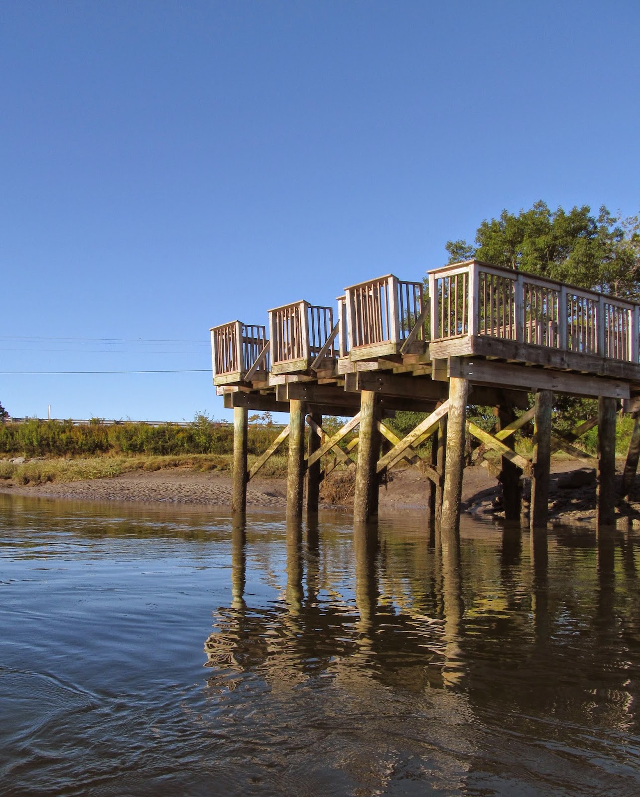
This area leads to the fishing pier/viewpoint and launch site.
Boat Launch: The area from which one should launch is rocky with a decent decline down to the water. Once down at the water, depending on the level of the tide, the entry into the water is gradual.
This is a picture of the area you walk down to get to the launch area.
Here is the location of the launch, over to the left.
On the opposite side of the pier, there is a sandy area. This is probably an easier launch site, but that sign posted there, says not to enter that area. (People had disregarded that sign, but I think it is important to respect the area and launch over on the rocky side.)

An important note: after launching you go to the right, heading under the bridge, to go to the beach. right before the pier there are some rocks just under the surface (tide dependent of course). I found these rocks the hard way, on the way back to the launch site I paddled up onto the bigger pile of rocks and got stuck in a way that left me a bit tippy. Fortunately my paddling partner was able to get in front of me and push me straight back, off the rock, then I tried to go to the left and got stuck on the other rock. Usually I can see rocks close to the surface, but these were hard to see. (This pic was taken at the end of the paddle, from the pier above, where the rocks are clearly visible.) As you can see paddling close to the shore on either side is the best bet to get through this part of the channel.

Looking up at the pier after putting in and heading for the beach.
Wildlife: Birds, birds, birds! Heron, Egrets, seagulls, and other birds whose names I do not know. This is a bird lovers paradise!
Notes: I owe this paddle to Ben, a loyal blog follower! He mentioned this adventure to me and I had told him I had tried paddling here a couple of years ago and was disappointed when my friends and I got there because, at the time, there was a sign that prohibited launching from here. It was a day where my friends and I ended up paddling the
Nonesuch River instead. (Click on that link for details about that trip!) Ben told me there was no longer any such sign...and he was right! (He also warned me that I would get stuck if the tide was too low and said I would be able to explore a shipwreck...yes I said shipwreck!)
For the last few weeks I have been keeping an eye on the tides, wanting to time it right so that I could go with the tide out to the beach and ride the tide back. If you are a loyal reader you know that I have had mixed success with timing the tides well. This one I timed pretty close to perfect! Low tide was listed as being at 9:50 or so...and I had unloaded and was on the water at about 8:00 a.m. (I would say going out two hours before low tide is a good idea.) The tide was going out and there were some places where the water was very shallow. (The good news here is that if the water is low and you get stuck, the bottom of the channel has a lot of sand, so getting out and maneuvering would not be that hard; there are many sand bars.)
As we began paddling we went under Rt. 77.
After the bridge it began to open up and felt like a marsh.
The morning light was beautiful.
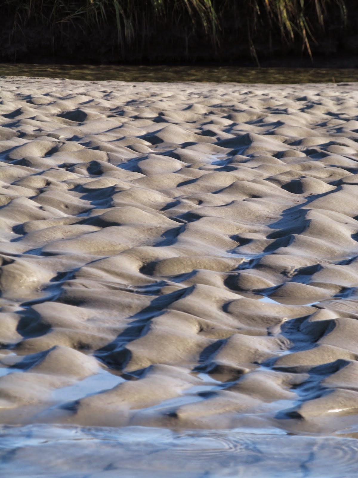
The sand bars had some cool textures.
The moon was still out...
The bird sightings were plentiful. I have been trying to get a picture of this bird in flight and finally did... it is a little blurrier when I enlarge it than I wanted, but love the angle!
There was some seaweed along some of the shoreline where there were bigger rocks.
These birds stood out so vividly...elegant...
This heron was between the shore and a large piece of the mud and grass that had detached... I like the shadow behind him...
They seemed to get along well...
The scenery was beautiful.
As we got closer to the ocean we came across some boats, beached, obviously, but a good sign we were in the right place. Getting to the beach was easy as the tide was going out. I thin kif the tide was high it would be a little more difficult to navigate as there are possible offshoots to the main part of the river, a good reminder to always keep track of your route to be able to return.
On the left there was a nice dock...
If you are paddling close to low tide, after passing this small building/dock, I would recommend pulling off to the right side, in the sand and take your boat out of the water.
It is possible to paddle out into the ocean, but I could see from where we were that the waves in the open ocean were decent size and we opted to get out of the water, pull the kayaks up on shore (quite far to avoid having to swim to them if the tide came in too quickly), and walk around, enjoy the beach. (Next summer, on a hot hot day, this trip will be at the TOP of my list of destinations!)
At this point you are on Higgins Beach. There was a lot to explore...
I love texture! The sand was very textured!
There it is!!! The shipwreck!! (This can be seen from Google Earth!) Ben shared with me that at high tide it is cool to paddle over the shipwreck. I am sure it is a very cool feeling. Because I am inexperienced at paddling in the ocean, I think I would be a bit nervous paddling over this area at high tide. The wreck is a little bit of a walk from the river, and I would worry that at high tide the waves may be bigger than I would want to navigate.
The history of the shipwreck, from what I learned online is this:
On August 10, 1897 the Howard H Middleton, a sailing ship being used to transport coal struck a ledge and took on water and sunk. No crew died in this shipwreck. I was relieved to learn nobody lost their lives. It was something I wondered about as I explored the wreck.
Vibrant green algae grows on the ribs of the ship.
It is a good sized boat.
How lucky am I? To live in Maine? To be so close to the ocean? And to be able to enjoy so much of it with my kayak?? VERY lucky!
It is fun to walk around on the beach and enjoy the views.
I kept returning to the wreck...
Looking back at the wreck from where we put the kayaks... the new and the old...
Across the river was a small airstrip from which this plane took off...was kind of cool to see that!
There is a nesting area on the beach. Please respect the rope fence and protect our endangered species.
This gull spent some time with us...
When other gulls joined him, his feathers got ruffled!
This is one of my favorite pics of the day. I love the texture!
Looking across the river. This is where we got out of our kayaks and put back in.
Paddling back to the launch site we passed these fishing chairs... we also passed a few kayaks and canoes. I am glad people living here are using the water!
I love that the water can be so shallow and still paddle-able in a kayak.
Birds!
This was a one legged bird. I kept watching it waiting to see the other leg, if it was bent up, but it wasn't... interesting...
Do you see it?
So well camouflaged!
Maine. The way life should be.
I would highly recommend this paddle for people who want to try paddling on a tidal river for the first time. It was easy to navigate and an amazing destination. Being able to get out and enjoy the beach was a lot of fun. I kept thinking that if it was a hot day it would have been so much fun to get out at certain spots to wade in the water and swimming at the beach would be awesome. (I would suggest taking some rope and perhaps a small mushroom anchor to attach to your boat(s) just in case you get so involved with the beach and swimming to pay attention to the incoming tide.) Leaving your kayak unattended at the beach could be risky. There were a good number of other people on the beach and many commented that they wish they had a kayak. I told them they should invest!
If you are paddling with the tide, I can see this would be very doable for paddlers of all ages and experience, but again, I would recommend getting to the beach at low tide and taking out before going out into the open ocean, especially if you are inexperienced or alone.
Most of the tidal rivers I have done are places where I would prefer to have paddling partners. This paddle would be a great deal of fun with friends, but I would also be comfortable doing this one solo.
Again... on the return paddle, watch for the rocks in the middle of the river, just after the pier, stay to the outer shores (right side has more space.)