Body Of Water: Back River & Sheepscot River [Maine Gazetteer, Map 7, C 1.5] This is a tidal location.
Directions: From Portland, take 295 North to Exit 28 Bath/Brunswick. Stay on Rt. 1 through Brunswick, Bath, and Wiscasset. As Rt. 1 takes you out of Wiscasset you will turn/bear right onto Rt. 27. Stay on Rt. 27 through Edgecomb and into Boothbay. Just after a convenience store and a baptist church you will want to depart from Rt. 27 by staying kind of straight onto Corey Lane, which then turns into Barter's island Road. You will pass Camp Knickerbocker and Knickerbocker Lake Recreational area on the right, then the Coastal Botanical Gardens on your left. You are close! You will come up a slight hill and as the road starts to descend you won't be able to see very far in front of you for a bit, then at the bottom of the hill and across the bridge the launch is right there!
(I strongly suggest using a GPS for this trip, head to the Boothbay
Botanical Gardens and instead of turning into the gardens stay straight,
then you will go down a hill and the boat landing will be right there!)

(You will notice there are TWO boat launch areas. KAYAKERS launch form the LEFT!) The Right side is reserved for boaters with trailers.

Boat Launch: There are a couple of choices for launch sites here. There is a gradual gravel put in location or a cement ramp. The cement ramp is accessible at all tides!
I like that they gave us our own side!! Thank you!!

This is the gravel entry. I suspect people swim from here as well, but am not sure.

This is the cement ramp. I opted for this ramp. With tidal rivers the boat ramps seem to get more algae on them, be careful of the slippery factor. (Though on this trip the ramp was algae free!) Here you can barely see the cement part below the pavement due to the tide.

View from the water of the cement ramp as the tide was almost at its highest. (Cement was under water, but pavement was fine!)
Parking: Paved & Lined. The parking area is for kayakers/canoeists/SUPers and for folks using the Knickerkane park for daily recreation. (A great picnic spot!) There are about ten angled parking spots as seen in the photo and room for probably 4 other vehicles closer to the cement launch, but 2 vehicles would need to park bumper to bumper in two separate spots. (Hope that makes sense!)

Bathroom: Yes. There is an outhouse on the small island where the picnic tables are. You need to walk over a footbridge to get there, the views are worth the walk!

Wildlife: Birds, terns, gulls, heron, pigeons, cormorants, fish (I think the huge fish I saw jump was a sturgeon), and seals! (If you are lucky!)
Notes: Loyal blog readers know that I stick to calm bodies of water. I like rivers with slow currents, ponds, lakes, and a few protected tidal rivers. But I love the idea of kayaking on the ocean and have hoped that one day I will be brave enough (and skinny enough) to do a real sea kayaking adventure. Kayaking with Orcas in the Pacific Northwest is on my bucket list! So... when a friend of mine said she had done this trip AND said she thought my recreational kayak would be fine for this trip I was very excited. While these two rivers are not technically the ocean, it sure feels like the ocean, complete with lobster buoys!
I got there a bit before my paddling partner and took time to walk out onto Knickerkane Island, at least that's what the sign said it was called.

Seeing the seaweed on the rocks, the enclosed area and the green water made me excited to see what else was in store!


My paddling partner had done this trip before, in a group, but before we started we looked at her map and made sure we knew where we were going. We also stopped several times on the trip, in protected areas, to make sure we knew where we were. Unfamiliar trips can be tricky, make sure you know where you are going, have a map, and have a partner!
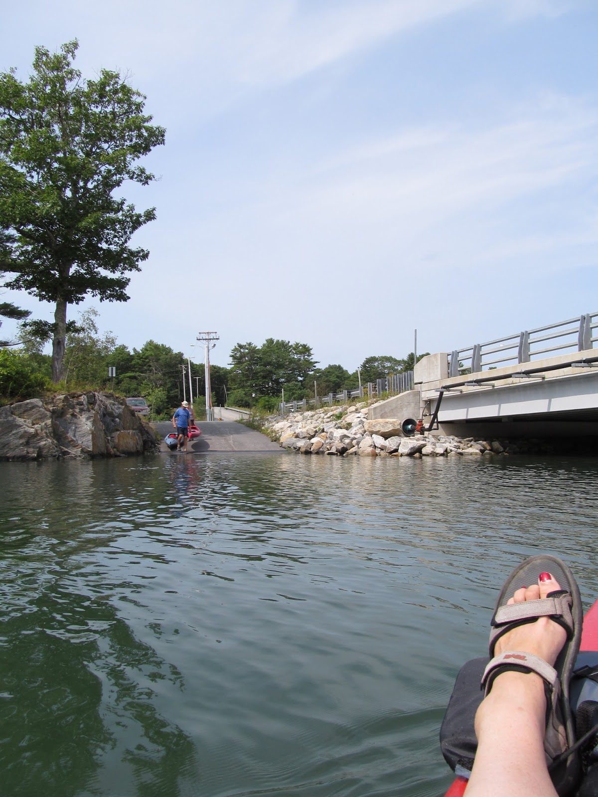
We headed under the bridge first!

This boat.. is sunk! As the tide got higher, the boat was less visible! (See later photo!)

After getting away from the boat launch we saw these birds hanging out. I looked that they were all together, different birds, just relaxing!

I wish this photo was more clear and closer.. always wanted a great photo of a heron in flight!

This guy... this guy was regal! Standing on a rock covered with seaweed, figuring out its next move! So cool! Oh, an important note: Thick areas of seaweed usually indicate areas of LARGE rocks below... I found that out when I thought I was going to tip! Avoid the thick seaweed!

Same heron, posing beautifully!

We went under the Trevett Swing Bridge. My paddling partner said this was the oldest bridge of its kind in Maine. It is designed to be swung open to let bigger boats through. (Later pics show some of the process.) It is still opened by human hands with some kind of crank/gear system.

This is the Trevett General Store... I wish I had thought to go here after we paddled, but forgot about it. As we paddled by I smelled bacon cooking, I suspect breakfast was being served! (At least breakfast sandwiches!) This store is on the edge of Hodgdon Island.

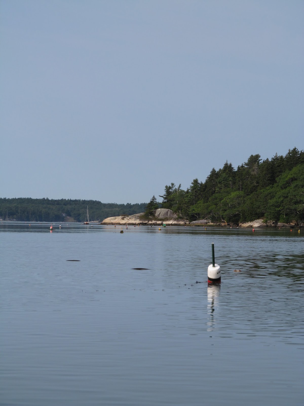
Looking out at the Sheepscot River. That river is very wide, very ocean-esque! My paddling partner said the water was so much calmer on this trip than when she had been before. The last time she was here it was in the afternoon. I am a firm believer in morning paddles for places that get wavy later in the day.
Not sure what kind of bird this is. It had the shape of a pigeon but the coloring of a gull. Would love to identify it if anyone knows! Thanks!

So peaceful. (There were a few boats out and about, most were going at reasonable speeds, but a couple were on a mission. Be mindful of the boats and their wakes!)


Do you see it?? My very first seal from my kayak! It was pretty far away, but I was so excited!

I had to zoom way in, but got his cute face!! Apparently, when the tide is a bit lower there are ledges near Ram Island where the seals often bask. The ledges were under water when we were out, so I felt very lucky to catch a glimpse of this guy!


I say if there is a lobster boat, lobster traps, and lobster buoys, it's ocean kayaking! This hard working lobsterman was enjoying his music that was, as my paddling partner said, 'right out of Compton!' Ha!

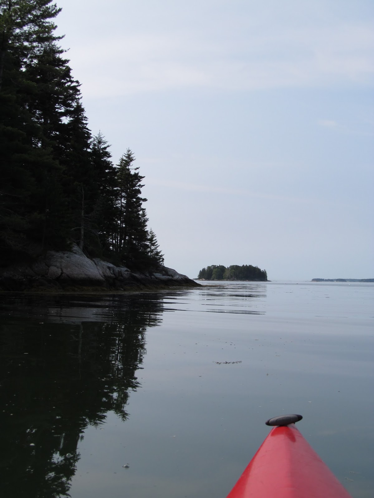
After heading out into the Sheepscot we went to the right and into this little cove. We believe it is part of a preservation, but are not sure.
Because we don't have a lot of experience on the Sheepscot we decided to not explore too far beyond where the Sheepscot and the Back River meet. We wanted to make sure the paddling route was a do-able route for people with similar experience. Again, we have heard it is rare for the Sheepscot to be this calm. If the waves are too big, don't risk it, in stead of paddling out into the Sheepscot explore the area between the general store and the Sheepscot opening. Then, keeping the general store (Hodgdon Island) on your left, hug that shore and you will end up going back around Sawyers Island up to Hodgdon Island and return to your starting point.


After exploring that little cove we headed back towards Back River and went just beyond that opening to Ram Island.


As we turned back from Ram Island heading back towards Back River another seal made an appearance. (Maybe it was the same one??!) I cannot wait to return to see if more seals say hello.

We thought about continuing to paddle towards The Isle of Springs, a bigger island not too far away, but again, we didn't want to push our luck. There will be other opportunities and as always safety is my top priority.
This pole, atop which there is an osprey nest, is a great landmark. It is where the opening of Back River meets the Sheepscot River.

Yet another heron wanted to say hello. This one was flying and landed very high in this tree. I think it is so cool that they go so high into the trees when they usually are walking in the water, fishing.

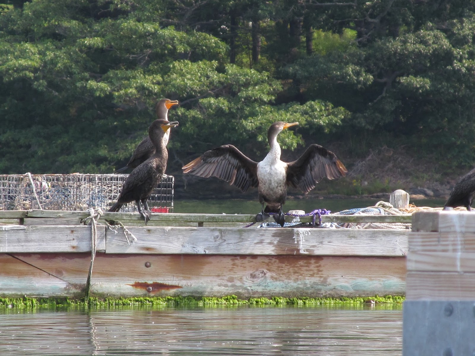
As we came back into the Back River, there were some docks. This one was a favorite for the cormorants!

From here we could look back at the Trevett Swing bridge and got to see it in action. Two boats needed to get through. They sounded an air horn a few times and a man came out and started turning the bridge. It opened slowly and was cool to watch!


Not sure what kind of ducks these are, but they were on a mission, speed demons!

This is one of those spots where you look down the channel and think it ends. (If the view was a little more to the right you would see trees.) But, as you keep paddling you come to this bridge on Sawyers Island Road. This little house was so cute. The owners take great pride in this home!


After going under the bridge we explored one of the little offshoots and it took us to another spot on Sawyers Island Road that connects Sawyers Island to what I will call the Mainland or Boothbay Harbor. If looking at a map, it looks like you can connect from this spot back out to the Sheepscot or from the Sheepscot back into the Back River to go around Sawyer Island. You cannot connect. (At least not without portaging with no great spots to put in or take out.) There is a small culvert under this road but it is not big enough for kayaks to go through. Again, Look at a map ahead of time and plan your route and stick to it!

On this side of Hodgdon Island the opposite shore is the Coastal Botanical Gardens. Pretty cool!

This is that same boat from the beginning of the post as the tide gets higher... I wonder why it has not been taken out of the water.

This trip!! This trip was great. I am so glad I took the time to do it and am planning to do it again soon. (So look for more pictures, hopefully with more seals!) This is a trip I would not do solo. My reasoning for that is that it is the ocean, or close enough to the ocean, which in my mind means that the conditions can change rapidly and drastically. The Sheepscot is a very busy river. As you can see by the many buoys in the photos, it is a working river. It is nice to have extra eyes on boats as you look around at the scenery. I also kept my life jacket on the entire time on this trip. Again, changing conditions and unfamiliar territory, like hidden rocks, could result in tipping over and it is smart to be safe. I don't think I would take kids on this trip, just because the waves could get big and the current could get strong, but parents need to use their best judgment. If you do take kids, please consider staying in Back River close to Hodgdon Island where it is more protected.
This trip may quickly rise to the top of my favorites.
Traffic Note: I got here early in the morning and there was no traffic. On my way home traffic got backed up in Wiscasset. This is a common occurrence and should be taken into account. I say, make a day of it, get up early to get on the water, then plan to go out to lunch on your way home or stop at Reid State Park/Popham Beach!