My Book!!

One opportunity that the blog has brought me is the co-authoring of a guidebook, Paddling Southern Maine! It is something in which I take a lot of pride! My writing partner, Sandy Moore, and I have created a book with 54 amazing trips that are within about an hour of Portland! Our motto as we wrote the book was wanting to 'get people to spend the day on the water and not in their cars!'

If you want more information on our book please click on the image of the book below.

Sandy and I are available to attend/present various functions/events. Please email me at mainekayakgirl@gmail.com for more information!

Sunday, May 28, 2017

Panther Run/Jordan Bay

Body of Water: Panther Run/Jordan Bay on Sebago Lake

Directions (From Portland, ME):  Head west on Rt. 302 into Windham.  Continue on 302/Roosevelt Trail through Windham and into Raymond.  At the intersection of 302 and 85 (across from Good Life Market) is Raymond Veterans Memorial Park.  Park at the park and there is a launch site there. 

Boat Launch: The boat launch at the Veterans Park is a grassy area that gradually enters the water.  Water levels vary here throughout the season. 

Parking: Free.  There are spaces for 6 to 8 vehicles. 

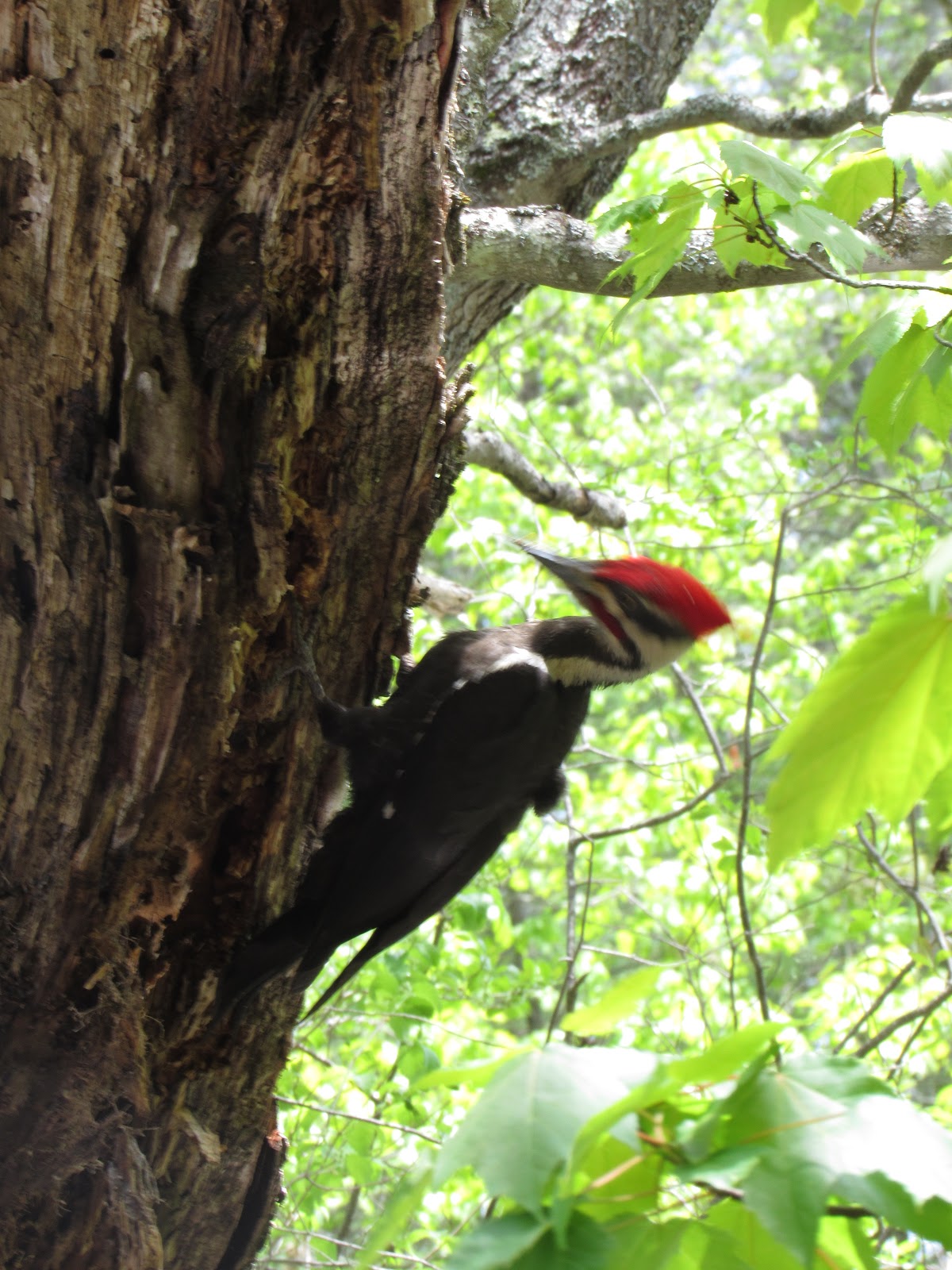
Wildlife: Turtles, Ducks, & songbirds

Notes: I was very pleased when Bill, from Sebago Trails Paddling, invited my co-author, Sandy, and me to join his paddling season kick off paddling event.  Bill anticipated that maybe a dozen people would want to join us to paddle.  It turned out that about 40 people showed up!  It was a lot of fun. I got to see some people I have paddled with before on some of the events through meetup.com.  I also got to meet some new people.. A win win!!

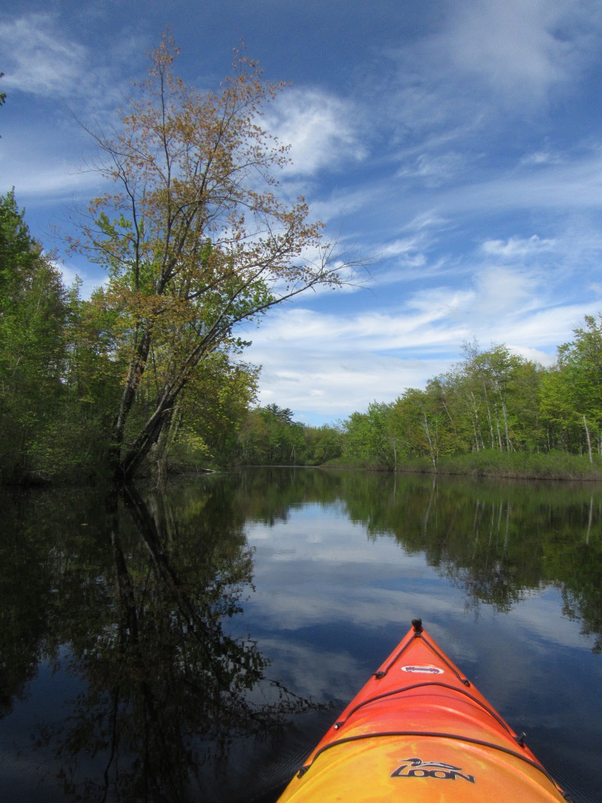
Panther Run is a place I had not paddled before.  I hope to do it again!  It will likely be hard to access as the water levels lower.  There are several trees down across this beautiful little river (not sure if it is a river but calling it that!)  and if water levels were lower it would have been hard to get over many of them.  Bill said later in the season there are parts that are not paddle-able because of the rocks.  So, if you are wanting to do this one, do it soon!  (Or wait until next year!)

Another note is that the bridge on 302 that you have to go under if launching from the Veteran's Park, has low clearance.  It was a little nerve wracking, but... worth it!  Either lean forward or do the kayak limbo and you will be just fine!  I also want to mention that going out to Sebago Lake is an option.  As you paddle out you will notice several large boats at docks...large boats.  Sebago is a huge lake with a lot of boat traffic.  If you go out into the lake, be safe!   Here are some pictures!  (Most of which are also on my facebook page so that I could 'tag' Sebago Trails so that people who participated today could find them more easily.)


It's Bill! 

This is Sandy, my coauthor, in her new boat!  (38 lbs light!!)  


This is the Mill St. dam.  Apparently you can launch onto Panther Pond from the other side of the dam.  I have not launched from there, but may try it! 


I am concentrating when taking this, so... don't mistake my concentration for a grimace, I was having a GREAT time! 


This shows the clearance.  The bridge is ok, but the pipe is low, and the other side of the bridge is low... but we all made it!


I don't usually  promote specific businesses here, but Sebago Trails is a GREAT company, not just for paddling equipment, but at creating opportunities for people to paddle!  If you are looking for equipment to buy or rent, call them!

Brownfield Bog

Body of Water: Brownfield Bog, Brownfield, ME [Maine Gazetteer Map 4, B2 ]

Directions (from Portland, ME): Follow Rt 25 through Gorham and Standish.  Turn right onto Rt 113 through Hiram and Baldwin into Brownfield.  Once the speed limit decreases you will be approaching an intersection, of 113 and 160.  Take Rt. 160 on the right.  Go over a bridge and 160 turns right, you need to stay straight onto Lord Hill Rd. Just after transitioning to Lords Hill Road   take an immediate left onto a dirt road, Bog Road, that looks like a driveway.   The dirt road is very narrow with lots of ruts and bumps. The ruts and bumps seemed extra bumpy and rutty on this trip!  

Boat Launch: The put in spots are a bit narrow. (There are two places to launch.)  It's easy to get in to the water's edge but can be a bit more challenging to get into your boat than other trips I usually post.   I get into my kayak by wading into the water and sitting into my kayak as if it were a chair.  This spot was a little hard for that because the bottom was mucky! An important note - remember where the launch sites are located, once you paddle away form them, they are easily lost as they blend in so far. 

Parking: There is room for 8-9 vehicles, in a little loop/turnout area.  I think any kind of trailer system would be hard to navigate.  Much better for people who transport their kayaks on top of their vehicles.

Wildlife: Birds (many songbirds, red winged black birds, & blue heron), turtles (snapping and painted), and large game has been reported.  I saw a moose on one trip here a few years ago. 

Notes: Have you ever had one of those weeks where you just NEED to get on the water? Well, that's where I was this week.  I don't necessarily promote paddling solo, especially for people with little experience, but... I know for me, sometimes there is nothing that can ground me more than some time, alone, in my kayak.  

As I drove down Bog Road I was a little disappointed when I noticed a car in my rearview mirror with two kayaks loaded on top.  I was disappointed because I selfishly wanted the bog to myself.  When I got to the parking area there were a few other vehicles as well... most of them were bird watchers.  I saw several people with binoculars along the first part of my paddle.  Luckily the bog was big enough for everyone.  It wasn't long before I was in my own little world.  The other paddlers were exploring other parts of the bog and the birdwatchers ran out of trail! 

The bog can be hard to access later in the season when the water levels decrease.  On this trip, the water was high and I got to explore places I haven't been able to explore before.  I would advise that people stay to the left as you leave the launch sites, follow the duck boxes to keep track of where you are.  I paddled for a long time, go to the 'end' of the bog where a beaver dam blocked my passage.  

Here are some photos:

It was still a bit dreary when I first arrived...

There were some bright colors along the way...

The owners of this duck blind may want to do some repairs...

So many places to explore with higher water levels! 

Reflections!

this beaver was unhappy with human presence.... he was being watched by me and by a few birders... he slapped his tail a few times... I kept my distance! 


This pair of geese seem to be watching a nest! 


And this is where I turned around... 

The sky had gotten blue... and it was beautiful! 


This muskrat didn't stick around long! 

It was a GREAT day on the water... MUCH needed time to decompress.  

I will say that it is bug season!  The mosquitoes were thick in the parking area and dissipated once i was on the water.  I was glad I had taken sunscreen AND bug spray!!  

Happy Paddling!

Monday, May 22, 2017

Listen to "Maine Calling" at 1 pm on 5/23 to hear about Recreational paddling in Maine


Tomorrow Maine Public Radio show "Maine Calling"  is having a panel discussion about Recreational paddling in Maine.

My writing partner, Sandy Moore,  and I are two of the guests. The show will air live at 1pm and will be rebroadcast at 8 p.m.

I look forward to meeting and chatting with folks with varying perspectives and roles within the paddle sport community!

Click Here to visit Maine Calling's Web page.


Tuesday, May 2, 2017

Information from the Coast Guard

In recent communication with the coast guard I inquired about getting some "Paddle Safe" stickers to share with folks who buy my book from me at different events. 
 
In addition to graciously giving me some stickers they shared this with me, knowing I would find it interesting.
 

This was an email sent from the NOAA (National Oceanic and Atmospheric Administration) who is partnering with the National Weather Service. I have been given permission to share it to help spread the word. Please share it as well, to help spread the word about safety.

"All,

Just to let you know, in conjunction with the U.S. Coast Guard, the Gray and Caribou National Weather Service offices will begin issuing Beach Hazards Statements late next week under the header of Coastal Hazards Message (CFW, WHUS41 KGYX) for situations when significant numbers of boaters are expected on the coastal waters, along with the combination of relatively warm air temperatures and dangerously cold water temperatures. An example of a message is below. In particular, our focus is on paddlecraft that could easily overturn and immerse people in the cold water. In addition to the cold water temperatures, frontal passages, wind shifts, or any situation with increasing or gusty winds, are particularly of concern, as these situations increase the chances that small watercraft could overturn.

I should note that although the "Beach Hazards Statement" was designed for our coastal waters, the dangers are similar on inland lakes until the lake waters warm up.

The USCG has found that water temperatures 60 degrees or colder are especially dangerous, which is often the case along the coast of Maine and New Hampshire through at least early summer. Without thermal protection, a victim can quickly become helpless due to hypothermia. Boaters should always be aware of the dangers of cold water, particularly during the early part of the boating season when the air is deceptively warm but the water remains cold. According to the USCG, when the water temperature is below 50 the average person has 30 minutes or less before they lose use of their extremities and can survive only an additional 2 hours provided they are wearing a USCG-approved life jacket

We would appreciate your help in alerting the public to this often underestimated danger. Although this program does not start until late next week, the warm temperatures and cold water this weekend will lead to potentially dangerous conditions."

Example Message:

URGENT - IMMEDIATE BROADCAST REQUESTED
Coastal Hazard Message
National Weather Service Gray ME
708 AM EDT Fri Apr 28 2017

MEZ023>028-NHZ014-281915-
/O.NEW.KGYX.BH.S.0001.170429T1200Z-170430T0000Z/
Coastal York-Coastal Cumberland-Sagadahoc-Lincoln-Knox-
Coastal Waldo-Coastal Rockingham-
708 AM EDT Fri Apr 28 2017

...BEACH HAZARDS STATEMENT IN EFFECT FROM SATURDAY MORNING
THROUGH SATURDAY EVENING...

The National Weather Service in Gray has issued a Beach Hazards
Statement...which is in effect from Saturday morning through
Saturday evening.

* Location...The beaches of and coastal waters off Rockingham

County in New Hampshire and York, Cumberland, Sagadahoc,

Lincoln, Knox, and Waldo Counties in Maine.

* Beach Hazard...The warm air temperatures in the upper 60s to

mid 70s may cause people to underestimate the dangers of the

cold water temperatures which are currently only in the low to

mid 40s.

* Timing...Saturday.

* Winds...Light southwest winds early in the day will increase

during the afternoon as a cold front approaches from the west.

Winds will shift to the northwest across western areas late in

the day and become gusty.

* Impacts...The cold water temperatures can quickly cause
hypothermia to anyone immersed in the water. Anyone on boats
or paddlecraft should use extreme caution to avoid this

threat.

PRECAUTIONARY/PREPAREDNESS ACTIONS...

A Beach Hazards Statement is issued on days when a significant
number of boats and paddlecraft are expected to be out on the
water and when warm air temperatures may cause people to
underestimate the dangers of the cold water. Paddle smart from

the start. Always wear your lifejacket.

Just last year, the United States Coast Guard Sector Northern New
England responded to 80 cold water incidents along the Maine and
New Hampshire shoreline.


According to the USCG, without a lifejacket, a victim suddenly
immersed in cold water may involuntarily inhale while under water
and drown without coming back to the surface. This can only be
prevented by wearing a lifejacket at all times while boating on
the cold water.
 
 
Thank you to the Coast Guard for reminding us all to be safe and for all of your efforts!!  

Sunday, April 30, 2017

Presumpscot River - Westbrook (Trip 20 in the book)

Body of Water: Presumpscot River [ Maine Gazetteer Map 5, 3E. Also look for the Westbrook map in the back of the gazetteer, which shows Lincoln St.]

Directions (From Portland, ME):  Head West on Rt. 25 (Brighton Avenue) towards Westbrook/Gorham.  Pass Kohl's plaza on Rt. 25 coming into Westbrook.  You will pass Amato's on your left and McDonald's on your right.  Stay straight.  Pass Dairy Queen on your left, go straight at the light.  You will come into a rotary type traffic pattern.  You will take the third off option to stay on Rt. 25, Almost going around Rite Aid.   (passing up the option to turn onto Warren Ave. and River Road by the mill).  Stay on Rt 25 coming into Main St. Westbrook. (Subway and Riverfront park on your right, then Cumberland Farms & Dunkin Donuts on left)  At light by post office & Big Apple, go straight.  Come down into Main St.  Turn Right at the light onto Bridge St.  (just beyond CVS, Fajita Grill/Frog & Turtle restaurants)

Once on Bridge St. You will pass mill on left.  Once Bridge St. begins to curve to the right, you will turn Left onto Lincoln St.  You will pass some condos on your left and will see an outdoor hockey rink.  You will park here, at the hockey rink. 

Boat Launch: This is a carry in boat launch.  There is a wide path that leads to the river, passing by the side of the hockey rink.  You will walk to the river and the boat launch itself is dirt.  You can not see the river from the parking area, but once you walk towards the river you will easily find your way.  It is a bit of a walk to the river from the parking area. (This time of year this path is pretty muddy.  It looks like someone had tried to get in there with a vehicle when it was too soft...be careful!) 

Parking: Free.  There is a lot of parking available next to the hockey rink.

Wildlife: Turtles, Ducks, many birds, deer,  beavers (I did not see any beavers, but saw signs!)  Great plant life, including pink lilies, late August/Early September. 

Notes: This is one of my frequent destinations.  It is close to home and I always see something different!  I have posted this spot often on the blog so won't go into too many details, but I will say the water level was the highest I have seen it...at least while paddling.  I was able to access places I usually cannot.  I also had a better view of the farmland up the river a bit being up a bit higher than usual.

Things still look so drab, but the buds are ready to explode.  With a few sunny days the leafs will be out and the reeds will begin to grow.


The high waters gave opportunities for exploration off the main part of the river.  

Yay!  The turtles were out! 

I love texture...and the intricacies of this root system with the reflection was something that caught my eye.  


This is a spot off the river which is usually so filled with reeds that it is not possible to get in there, but I paddled around quite a bit back there... 

Oooooooh!  There she is... my favorite tree!  She is still standing...and ready to bloom! 

As I paddled I saw this feather caught in the tree... it was a pretty feather... 

I see signs of beaver on this river often, but have only seen a beaver once or twice.  

 This was on the other side of the tunnel.  (The tunnel pic won't upload for some reason!)  

This guy seemed to have no fear.  

It was nice to see the grass greening up so nicely.  I also liked that there was a canoe propped up against that fence.  I did not see any cows... 

but off in the distance I saw four deer.  


I had to zoom way in to get these shots... sorry they are not better! 

So even though the temps were up, the sun was a bit shy... by the time I got back to my split tree the sun was hiding a bit... but I like how the tree looks here...


On my approach to the take out the sun finally came out and it was beautiful!  I am so happy to be on the water again!  I loved my new ride up the river as well... I did use the console on the dashboard, but did take off the water bottle holder and it worked better... I am still not sold on having it on all the time, but... I can see some benefits to it!  (I was able to set my camera on it to get some nice videos!)