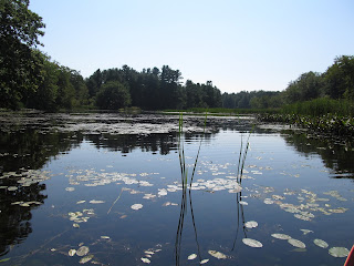
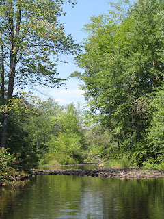
Body of Water: Salmon Falls River, Border of Maine/New Hampshire, between South Berwick, ME and Rollinsford, NH, [Maine Gazetteer, Map 1, A3]
Directions: From Portland take 95 south to Exit 19 (Wells/Sanford), Turn RIGHT off the exit ramp ont Rt. 9 W for 0.6 miles. Turn LEFT to stay on Rt. 9 West, for 6.5-7.0 miles, then turn LEFT onto Rt. 4 for about 6.5 miles, turn RIGHT onto Rt. 236 for 0.2 miles, then turn LEFT onto Main St. (At the traffic island.) Stay on Main St. for about 0.4 miles, as you cross the bridge, crossing the ME/NH border, you will take a slight right onto Scoutland Rd. and Bicentennial Park is on the Right. (There is no sign for the park until you get towards the launch.)
As you enter NH...just after the bridge...

As you cross the ME/NH bridge you will see this on the right. You will be launching above the dam.
Right after the bridge, turn right into this park.
Go under the bridge to the launch/parking area
Boat Launch: Gradual slope gravel/grass/ some pavement
Parking: There are several places to park along the road into the launch as well as a bigger parking area on the left.
Bathroom: No
Wildlife: Turtles and birds
Notes: A couple of years ago, one of my blog readers suggested I explore the Salmon Falls River. He said it was a slow moving river, unique because of its status as a river that defines the border between Maine and New Hampshire. The paddle was worth the trip and as silly as it is, I admit that as I paddled from shore to shore, I would think, 'I'm in Maine'... 'Now I'm in NH!" It was fun...
This is the view to the right just after putting in, towards the dam. Obviously you need to paddle to the left, AWAY from the dam.
Before coming to this river I had googled it to see what I could find... I found a post (maybe from the blog reader who suggested this river) that said there was a territorial swan in the area and to bring bread to feed it... I brought the bread, but didn't find the swan. I was a bit sad about that, but there were a lot of other endearing elements of this trip. When I first put in, the river was pretty wide but narrowed soon and there are several places, smaller offshoots to explore... loyal blog readers know I prefer the offshoots to the wide open areas, so that's where I spent most of my time.
I did this trip on Labor Day, so there was still plenty of greenery and several white lilies.
One part of this trip that bothered me was the amount of milfoil in the river. In this photo you can see the milfoil in the water.
The milfoil was thick and in every offshoot of the river. a reminder to clean your boat between trips!
This is a good picture to show the wider part of the river.
I like the variety of vegetation along the river. I think that may be one reason I prefer rivers to lakes/ponds.
If you look closely, you can see turtles on that log...
more milfoil...
I really liked the secluded areas off the river. They were very peaceful.
The offshoots also provided some appreciated shade to escape the heat!
This turtle is shedding it's shell. From what I have read this is normal. The shells are like bone and grow from the inside out, and the outer layers peel off. (The New Hampshire turtles seemed quicker to abandon their logs as I paddled by... the Maine turtles seemed a bit more brave... but then again, I could be biased!)
I paddled beneath a bridge (which I thought would mark the end of the trip as it looked, at first, like a dam...but I was able to keep going) and saw this view. I had to choose to go left or right, I chose the right...
In this upper part of the trip, there were several tires in the water... cleaning this river would be a great project for an environmental group.
I paddled as far as I could up this offshoot. It was a beautiful spot.
At one point there had been a bridge here. I thought I could keep going beyond this spot and reconnect with the other part of the river, but it was too shallow. So I returned to the area where I had to choose which way to go... and went up the other branch...
It is hard to see, but this is a very large snapping turtle...I was trying to get some other pics, but some other paddlers came through and I had to move to get out of their way and when I moved back he was gone.
After going up the other branch of the river it ended with this... it was very pretty...
Pretty except for this giant piece of metal in the water... it looks like an old culvert... and I am surprised it is still in the water, looks like it has been there for a long time.
Love the sparkles in the water! And a decent plug for Old Town Canoe/Kayak!
I paddled slowly back to the launch site...
There were a lot of people using the river this day... I saw a tandem kayak team, a canoe with a family of three, another kayaker and his young child who was giggling about being on the water... and there were several people at the park who were swimming and spending time on the shore. It seems to be a well used park.
The draw, I think, of this river, would be that it is a border between Maine and New Hampshire. I would imagine that in the fall, once the colors start coming, it would be a wonderful place to explore.
I cannot say that this is one of my favorite spots...only because of the large amounts of milfoil and the tires and metal in the water... but I really enjoyed the many off shoots to explore!


Crazy question...but was this stretch of the river swimmable? If someone were to swim downstream with a kayaker escort? Thanks, Mark.
ReplyDeleteHi! I'm not sure... the day I was there someone was in one of those inflatable fishing tubes but not sure how far up river he went. It was pretty shallow in some places...but other places looked swimmable... hard to say... people were swimming at the launch... sorry I am not sure.
ReplyDeleteI have never read your blog before but you wrote so clearly and your photos were wonderful. I recently bought 14 acres in S. Berwick and hope to explore the nature around the area. I prefer rowing to kayaking, only because of a shoulder issue, but I don't have a boat yet. I look more of reading more of your posts.
ReplyDeleteThank you! I hope you get a boat and enjoy! There are so many amazing places to paddle!
Delete